


 84 / 130

[
] 84
access
to
water
and
sanitation
for
all
With summer rainfall of ~600–1,000 mm pa, the catch-
ments are marked by steep topography, with the pronounced
Drakensberg Escarpment forming the headwaters of the
catchment, followed by a second smaller escarpment in
the lower catchment. Habitat units include rocky outcrops,
montane grassland, pockets of Afro-montane forest, Acacia
savannah and wetlands and riparian zones with pockets of
highly erodible soils, especially on abandoned cultivated
lands. Soils become more erodible towards the lower parts
of the catchment, as is demonstrated by the extensive gully
features there. Siltation prevention measures could substan-
tially increase the life-span of the dam with major direct
economic benefits: every 5% increase in the life-span of the
dam could save approximately R1 billion in 2015 currency.
Various socio-economic factors contribute to land degrada-
tion. The key historical elements that have impacted on the
dam catchments are: the political and administrative sepa-
ration of the former Transkei homeland from SA; laws that
restricted ownership of land; the loss of able bodied men
who were enrolled to work in the mines thus reducing avail-
able labour in the rural areas; pass controls which prevented
women from living in urban areas with their husbands; and
limited investment in education, especially at school level.
Social grants in the form of pensions have also affected
people’s reliance on the land, often abandoning agricul-
tural land and practices. Current levels of degradation make
any new agricultural activity unlikely to remain successful
without continued support and investment.
Poverty prevails within the catchment areas. Investment
priorities are therefore focused on the alleviation of poverty
and the creation of sustainable jobs that allow the catch-
ment ecosystems to perform their proper functions. The
Ntabelanga and Lalini Ecological Infrastructure Project
(NLEIP) aims at erosion prevention, the avoidance of habitat
degradation and general rehabilitation efforts in the Tsitsa
catchment (T35), particularly those that reduce the amount
of likely sediment deposits in proposed dams and associated
infrastructure.
The vision for the programme is “to support sustainable
livelihoods for local people through integrated landscape
management that strives for resilient social-ecological systems
and which fosters equity in access to ecosystem services.” The
investments in restoring and maintain ecosystems and their
functioning in an optimal condition will sustain benefits that
will accrue from the health of the water infrastructure – crops
and pastures from irrigation, power supply from the hydro-
electric plan and, most importantly, potable water for those
communities that have previously been most disadvantaged.
This will be linked to the activities of the fledgling Catchment
Management Fora (CMFs) in the area.
It is intended that these joint actions and events will be
carried out in a manner that engages and involves local
communities, both sensitively and with a view to their own
benefits. Ecosystems and their functionality are the great-
est natural asset to the social-ecological system. It not only
protects the direct benefits from ecosystems, such as fertile
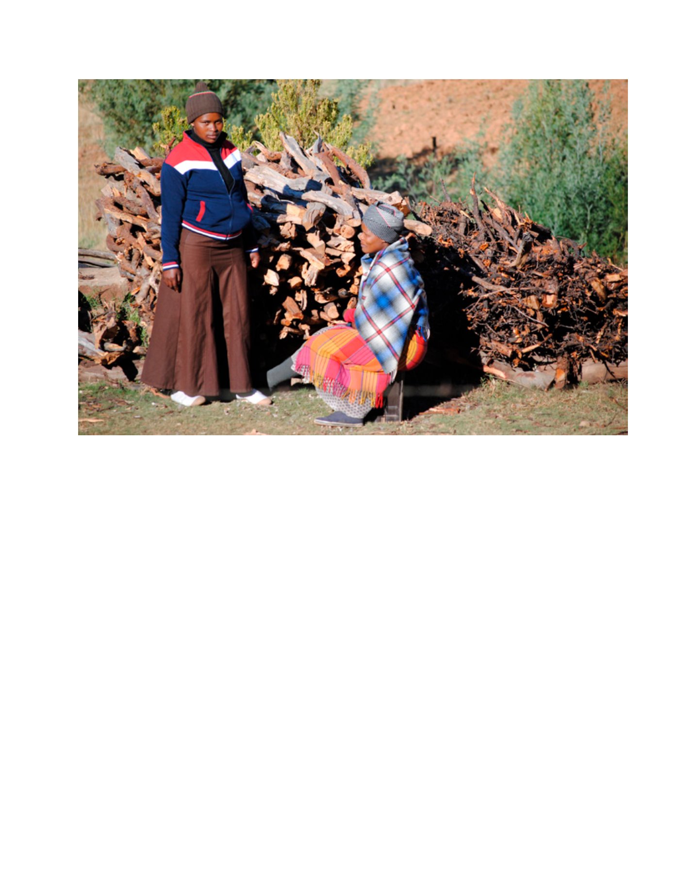
Women collecting fuel wood during autumn in Upper Umzimvubu
Image: DEA RSA