


 87 / 130

[
] 87
A B
et ter
W
or ld
A thorough stakeholder assessment of the sub-catchments
related to the proposed Ntabelanga Dam – the first proposed
dam of the two – was conducted in 2016.
2
The results from
the assessment and the ongoing research clearly showed
the complexity of the governance and land use within the
catchments. These complexities are a challenge, but with
a larger investment in communication, and dedicated staff
within the catchment dealing with community engagement,
these complexities are better understood and planned for.
Despite the presence of various government departments in
the catchment, natural resource-related decision making is
mainly controlled by individual farmers – with advice and
support from their agricultural suppliers – and traditional
authorities – chiefs, headmen and sub-headmen.
Planned restoration work will be done through the govern-
ment’s poverty alleviation mechanism, the Expanded Public
Works Programme and implemented by DEA NRM. These
restoration operations will potentially create 558 real jobs
in the green economy per year. This should equate to R450
million injected into the local economies of the catchments.
The restoration work in conjunction with the sustainable
land use management implicit in the Ntabelanga Lalini
Ecological Infrastructure Project goals can be seen as an
insurance policy for all the South African governments’
investment in infrastructure in the catchment.
The standard approaches to ecological restoration deals
directly with the problem and not the cause of the problem.
Gully head erosion in wetlands is stopped with engineering
interventions in most instances, but the driver of the degra-
dation is generally not dealt with. NLEIP aims to identify
the drivers and implement the required change to reduce the
land degradation whilst dealing with the identified problems
within the priority ecosystems.
The management of invasive alien plants is being done
differently in these catchments. The standard approach
works from the top of the catchment down to the bottom.
The NLEIP has investigated which species are being used by
local communities and which sites the communities would
like to have remain intact. The invasive species are primarily
used for firewood and building materials. A comprehensive
plan is being developed to allow invasive woodlots while
clearing the remainder of the invasive plants.
The injudicious use of fire in the catchment needs to be
addressed thorough fire management plans that are devel-
oped with the land users and the communities living within
the catchment.
The restoration of wetlands, grasslands and forests is
carried out in a manner that supports local business develop-
ment. The restoration material, plants, grasses and tree seeds
are harvested within the catchment and grown by the local
communities. The plants and trees are then bought from
them for the restoration work, which they in turn plant and
take responsibility for, thus creating a chain of ownership
and responsibility. Baseline monitoring of restoration efforts
in the catchment is done by trained community members
instead of using universities and specialists.
The socio-ecological model for these catchments is centred
on people and their livelihoods. This project aims to build
intervention measures for improved ecosystems functional-
ity that will, in turn, allow greater access to water and for a
longer period of time.
This initiative has thus tried in a bold and ambitious way,
to view its challenge through a social-ecological lens – one
which considers both social and biophysical domains jointly,
not with physical on one side and social on the other. Apart
from the participatory emphasis being promoted across the
many appropriate levels of resource use and governance, the
culture that the project is striving to engender is also explicitly
reflexive, using feedback and learning principles from strate-
gic adaptive management and developmental evaluation
3
.
Given the task at hand, and the particular history of the
catchment, the situation described in this article has taken
several years to start realising in this aspirational form.
With this longer start-up investment as a basis, the Natural
Resource Management Programmes organisation hopes to
trial in practice what has long been envisioned – navigating
through the complex reality in a manner which takes cogni-
sance of that complexity. This realisation is in its early stages
and there are no illusions about the multiple challenges, but
it is hoped that it will create a more appropriate approach
towards sustainability.
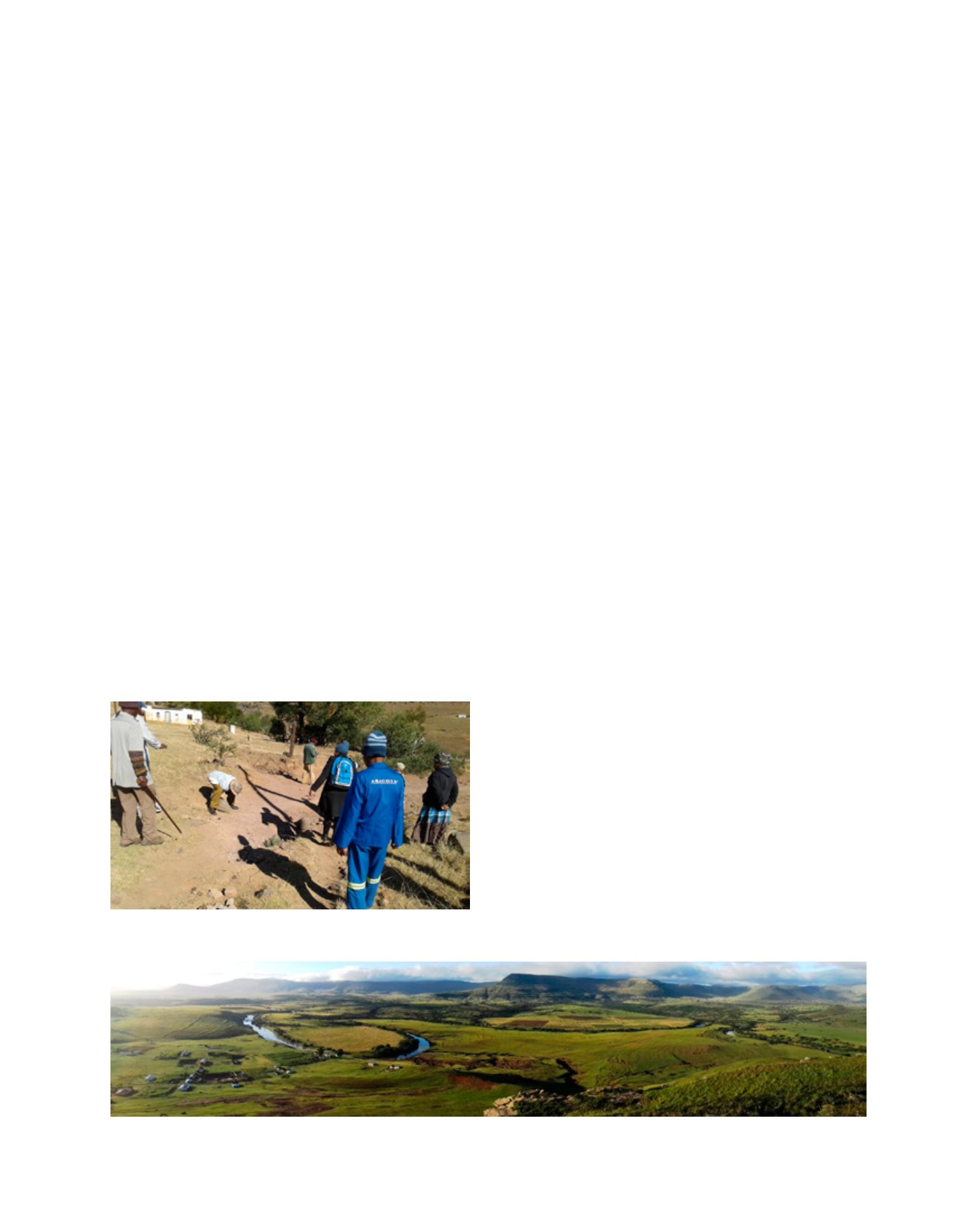
Sunrise over Shukunxa Village in the NLEIP catchment
A typical large erosion feature that has reached bedrock and is now steadily
progressing laterally and removing valuable topsoil
Image: Dylan Weyer
Image: DEA RSA